2017
SO8276 : Canal east of Blakebrook in Kidderminster, Worcestershire
taken 7 years ago, near to Blakebrook, Worcestershire, England
This is 1 of 3 images, with title Canal east of Blakebrook in Kidderminster, Worcestershire in this square
Canal east of Blakebrook in Kidderminster, Worcestershire
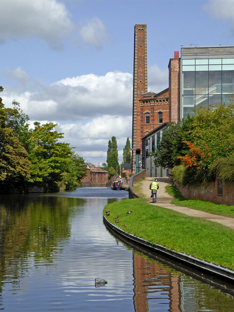
This is the Staffordshire and Worcestershire Canal in Kidderminster, looking north-west towards the town centre. Ahead is the preserved chimney of Slingfield Mill, a former Victorian worsted mill which belonged to Brinton's Carpets during the second half of the 20th century, until the 1980s.
 Map © Crown Copyright")
TIP: Click the map for more Large scale mapping
- Grid Square
- SO8276, 418 images (more nearby 🔍)
- Photographer
- Roger D Kidd (more nearby)
- Date Taken
- Wednesday, 23 August, 2017 (more nearby)
- Submitted
- Thursday, 22 February, 2018
- Subject Location
-
OSGB36:
 SO 8296 7644 [10m precision]
WGS84: 52:23.1432N 2:15.1073W - Camera Location
-
OSGB36: SO 8299 7638
- View Direction
- North-northwest (about 337 degrees)