2018
NH6037 : Bona Lighthouse
taken 6 years ago, near to Lochend, Highland, Scotland
This is 1 of 4 images, with title Bona Lighthouse in this square
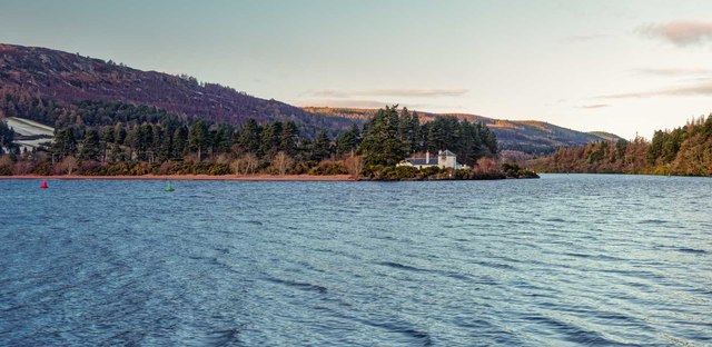
Bona Lighthouse
Loch Ness, the bona Lighthouse marks the passage for ship up the Caledonian Canal along the strip of water to the right of the lighthouse that links Loch Ness to Loch Dochfour
 Map © Crown Copyright")
TIP: Click the map for more Large scale mapping
- Grid Square
- NH6037, 57 images (more nearby 🔍)
- Photographer
- valenta (more nearby)
- Date Taken
- Monday, 12 February, 2018 (more nearby)
- Submitted
- Thursday, 22 February, 2018
- Subject Location
-
OSGB36:
 NH 6017 3759 [10m precision]
WGS84: 57:24.4275N 4:19.7478W - Camera Location
-
OSGB36: NH 6011 3739
- View Direction
- North-northeast (about 22 degrees)