2017
SH8077 : North Wales Expressway (A55), Flyover Junction 19
taken 7 years ago, near to Llansanffraid Glan Conwy, Conwy, Wales
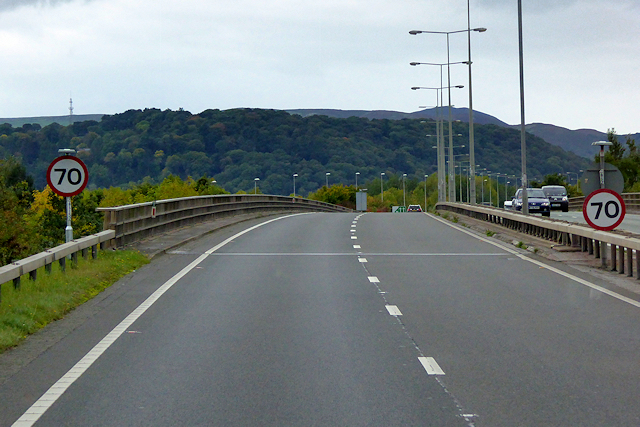
North Wales Expressway (A55), Flyover Junction 19
The A55, also known as the North Wales Expressway (Gwibffordd Gogledd Cymru), is the major road in North Wales running for 88 miles between Chester and Holyhead via Conwy and Bangor.
The A55 is a very high quality road, much of it rebuilt since the 1970s in response to traffic problems in Colwyn Bay, Colwyn and Llandudno caused by traffic having to pass through town centres on totally unsuitable streets, (especially in Conwy where lorries often scraped their paintwork as they passed through 12th century arches in the town's walls), leading to the construction of an east-west expressway bypassing the urban centres. It is a dual carriageway primary route for its entire length with the exception of the point where it crosses the Britannia Bridge over the Menai Strait. All of its junctions are grade separated except for two roundabouts; one east of Penmaenmawr and one in Llanfairfechan. The road originally ran from Chester to Bangor but was extended parallel to the A5 across Anglesey right into Holyhead Docks in 2001.
Link SABRE
SABRE
See other images of The North Wales Expressway (A55)
The A55 is a very high quality road, much of it rebuilt since the 1970s in response to traffic problems in Colwyn Bay, Colwyn and Llandudno caused by traffic having to pass through town centres on totally unsuitable streets, (especially in Conwy where lorries often scraped their paintwork as they passed through 12th century arches in the town's walls), leading to the construction of an east-west expressway bypassing the urban centres. It is a dual carriageway primary route for its entire length with the exception of the point where it crosses the Britannia Bridge over the Menai Strait. All of its junctions are grade separated except for two roundabouts; one east of Penmaenmawr and one in Llanfairfechan. The road originally ran from Chester to Bangor but was extended parallel to the A5 across Anglesey right into Holyhead Docks in 2001.
Link
See other images of The North Wales Expressway (A55)
 Map © Crown Copyright")
TIP: Click the map for more Large scale mapping
- Grid Square
- SH8077, 83 images (more nearby 🔍)
- Photographer
- David Dixon (more nearby)
- Date Taken
- Sunday, 24 September, 2017 (more nearby)
- Submitted
- Friday, 23 February, 2018
- Subject Location
-
OSGB36:
 SH 807 774 [100m precision]
WGS84: 53:16.8186N 3:47.3651W - Camera Location
-
OSGB36: SH 808 774
- View Direction
- West-southwest (about 247 degrees)