SX0144 : Mevagissey Harbour
taken 7 years ago, near to Mevagissey, Cornwall, England
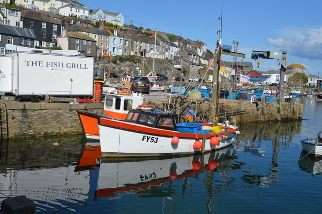
The harbour is built on the site of a medieval quay. The first Act of Parliament allowing the new port to be built was passed in 1774. The inner harbour, consisting of the current East and West Quays, was constructed from this time. An outer harbour was added in 1888, but seriously damaged in a blizzard in 1891. The outer walls were rebuilt by 1897. The harbour was given charitable trust status in 1988.
In 1880 there were around sixty fishing-boats engaged in the mackerel fishery, and herring and pilchards were also important fisheries.
There are currently 63 registered fishing vessels in the harbour.
Mevagissey is a village and fishing port. The village is situated five miles south of St Austell.
It nestles in a small valley and faces east to Mevagissey Bay. The inner and outer harbours have a mixture of pleasure vessels and fishing boats, the remains of a once major industry. However, tourism has supplanted fishing as the dominant industry in recent years.
Mevagissey village centre consists of narrow streets with many places to eat and shops aimed at the tourist trade. The outer areas are built on the steep slopes of the surrounding hillsides and are mostly residential.
 Map © Crown Copyright")
- Grid Square
- SX0144, 347 images (more nearby 🔍)
- Photographer
- N Chadwick (more nearby)
- Date Taken
- Friday, 1 September, 2017 (more nearby)
- Submitted
- Wednesday, 28 February, 2018
- Subject Location
-
OSGB36:
 SX 0151 4479 [10m precision]
WGS84: 50:16.1785N 4:47.2013W - Camera Location
-
OSGB36: SX 0149 4480
- View Direction
- East-southeast (about 112 degrees)