2018
SH5674 : Melin Llandegfan
taken 6 years ago, near to Llandegfan, Isle of Anglesey/Sir Ynys Mon, Wales
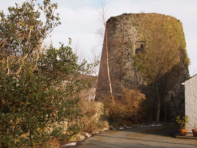
Melin Llandegfan
Thought to have been built in the 1820's and fallen into disuse before the first world war. Remains of the cap and sails were reported as still in place in 1929, but had disappeared by the late nineteen thirties. The upper courses were removed at some time later. The windmill was then used as a water tower for the village, a storage tank being fitted and water abstracted from the Afon Cadnant. However this was replaced by a water main and the redundant tnk was finally removed in 1989.
 Map © Crown Copyright")
TIP: Click the map for more Large scale mapping
- Grid Square
- SH5674, 38 images (more nearby 🔍)
- Photographer
- Chris Andrews (more nearby)
- Date Taken
- Saturday, 3 March, 2018 (more nearby)
- Submitted
- Monday, 5 March, 2018
- Subject Location
-
OSGB36:
 SH 5660 7401 [10m precision]
WGS84: 53:14.6212N 4:9.0261W - Camera Location
-
OSGB36: SH 5659 7402
- View Direction
- Southeast (about 135 degrees)