2018
NT2338 : Forest edge, Cademuir
taken 6 years ago, near to Kings Muir, Scottish Borders, Scotland
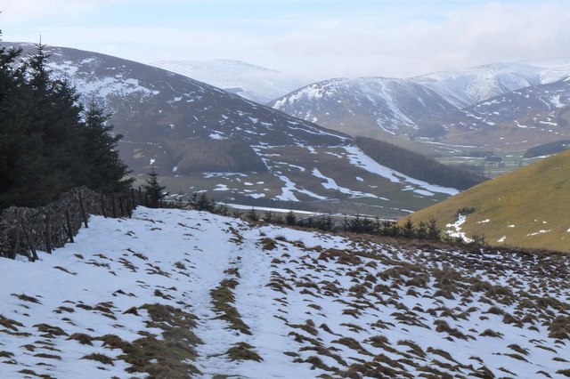
Forest edge, Cademuir
Near the subsidiary summit above the Red Well, looking into the Manor Valley to Canada Hill with Posso Craig (centre) and Dollar Law beyond to the left.
 Map © Crown Copyright")
TIP: Click the map for more Large scale mapping
- Grid Square
- NT2338, 74 images (more nearby 🔍)
- Photographer
- Jim Barton (more nearby)
- Date Taken
- Sunday, 11 March, 2018 (more nearby)
- Submitted
- Tuesday, 13 March, 2018
- Subject Location
-
OSGB36:
 NT 2397 3816 [10m precision]
WGS84: 55:37.8623N 3:12.5482W - Camera Location
-
OSGB36: NT 2402 3822
- View Direction
- Southwest (about 225 degrees)