2018
NS7893 : Former gravel pit in King's Park
taken 6 years ago, near to Stirling, Scotland
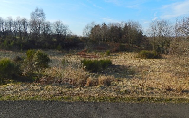
Former gravel pit in King's Park
There is a noticeable hollow here, with a resemblance to a drained body of water, but, as noted at NS7893 : King's Park: remains of the race track, it has a quite different origin: it is labelled "gravel pit" on the first-edition map (185860).
 Map © Crown Copyright")
TIP: Click the map for more Large scale mapping
- Grid Square
- NS7893, 77 images (more nearby 🔍)
- Photographer
- Lairich Rig (more nearby)
- Date Taken
- Saturday, 24 February, 2018 (more nearby)
- Submitted
- Thursday, 15 March, 2018
- Subject Location
-
OSGB36:
 NS 7896 9313 [10m precision]
WGS84: 56:6.9317N 3:56.8934W - Camera Location
-
OSGB36: NS 7899 9310
- View Direction
- Northwest (about 315 degrees)