SE2824 : Ardsley Reservoir: slipway?
taken 6 years ago, near to West Ardsley, Leeds, England
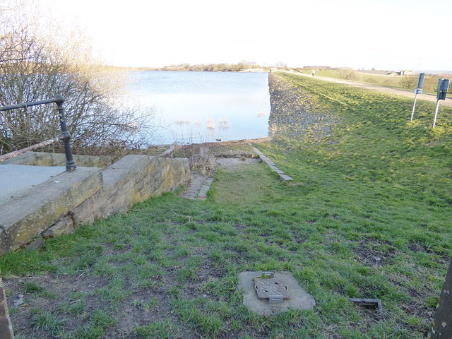
Ardsley Reservoir (also known as East Ardsley, or Haigh Moor) is situated west of Wakefield.
This reservoir is unusual in that it is not an impounding reservoir (primarily fed by natural streams or rivers) but, in modern terminology, an "En-route Storage Reservoir" (ESR) meaning it holds water delivered from other sources, prior to treatment.
Constructed in 1880 for the Wakefield and District Water Board, it is fed mainly from the Board's upland reservoirs in the Ryburn Valley (Booth Wood, Baitings and Green Withens). Following the 1995/6 drought in Yorkshire, an emergency main was laid to feed the reservoir with water from underground aquifers in the east of the region in the event of a future water shortage.
The surface area is about 22.5 hectares; I have not managed to find a figure for its total capacity. The spillway is steep and non-stepped, and was lined with sprayed concrete in 2016 to prevent erosion.
Although it still supplies Wakefield with water, there is also a large private client: Coca-Cola, whose large bottling plant in Wakefield is supplied direct from this reservoir.
There is public access to a surfaced track around the perimeter of the reservoir.
 Map © Crown Copyright")
- Grid Square
- SE2824, 102 images (more nearby 🔍)
- Photographer
- Stephen Craven (more nearby)
- Date Taken
- Sunday, 25 March, 2018 (more nearby)
- Submitted
- Tuesday, 27 March, 2018
- Subject Location
-
OSGB36:
 SE 2877 2476 [10m precision]
WGS84: 53:43.1078N 1:33.9313W - Camera Location
-
OSGB36: SE 2876 2476
- View Direction
- EAST (about 90 degrees)