2014
NB1142 : Stac an Tùill of Bearasaigh
taken 10 years ago, 4 km NW of Bostadh, Great Bernera, Na h-Eileanan an Iar, Scotland
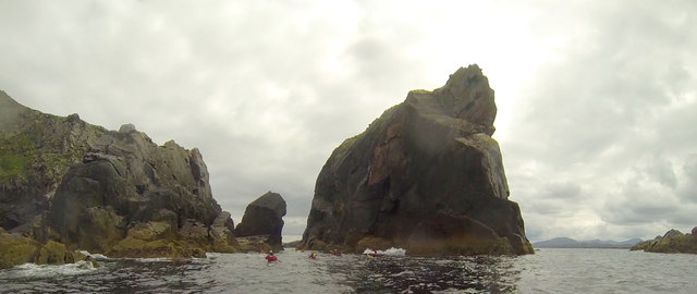
Stac an Tùill of Bearasaigh
Returning from Seanna Chnoc on our way to Bostadh, the most interesting route seemed to be to thread the Caolas Stac an Tùill on the west side of Bearasaigh. This 43m high stack is prominent in the view from Bostadh, and is scarcely less in height than the island of Bearasaigh itself (58m). However, there are other skerries (off to the right of the view) providing some shelter here, so the swell as we came into the channel was quite a bit less than it had been earlier in our trip, and towards the southeastern end, the water was almost calm.
 Map © Crown Copyright")
TIP: Click the map for more Large scale mapping
- Grid Square
- NB1142, 3 images (more nearby 🔍)
- Photographer
- Andy Waddington (more nearby)
- Date Taken
- Thursday, 17 July, 2014 (more nearby)
- Submitted
- Saturday, 31 March, 2018
- Subject Location
-
OSGB36:
 NB 1196 4245 [10m precision]
WGS84: 58:16.5593N 6:54.9062W - Camera Location
-
OSGB36: NB 1191 4250
- View Direction
- Southeast (about 135 degrees)