2018
SN2439 : Gelli-deg
taken 6 years ago, near to Abercych, Pembrokeshire/Sir Benfro, Wales
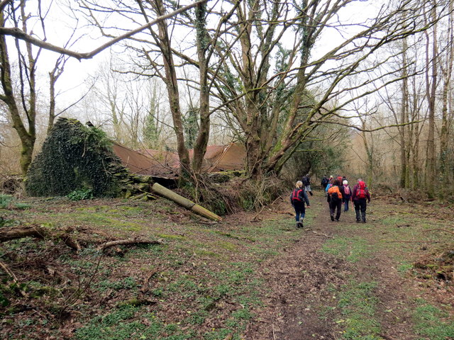
Gelli-deg
Llwybr cyhoeddus yn mynd heibio i dai mas adfeiliedig Ffarm Gelli-deg.
Public footpath passing the ruinous outhouses of Gelli-deg Farm (trans. fair grove).
Public footpath passing the ruinous outhouses of Gelli-deg Farm (trans. fair grove).
 Map © Crown Copyright")
TIP: Click the map for more Large scale mapping
- Grid Square
- SN2439, 3 images (more nearby 🔍)
- Photographer
- Alan Richards (more nearby)
- Date Taken
- Sunday, 1 April, 2018 (more nearby)
- Submitted
- Sunday, 1 April, 2018
- Subject Location
-
OSGB36:
 SN 2489 3955 [10m precision]
WGS84: 52:1.5989N 4:33.2281W - Camera Location
-
OSGB36: SN 2487 3953
- View Direction
- Northeast (about 45 degrees)