2018
SJ2785 : Bench mark in Arrowe Park Road, Woodchurch
taken 6 years ago, near to Irby, Wirral, England
This is 1 of 2 images, with title starting with Bench mark in Arrowe Park Road in this square
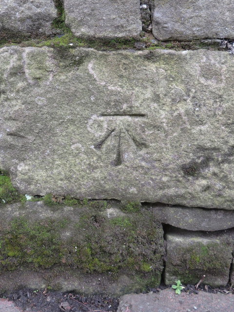
Bench mark in Arrowe Park Road, Woodchurch
This Ordnance Survey bench mark is cut into the roadside wall in Arrowe Park Road. Although the stone wall is very long, the mark is fairly easy to find as the grass verge has been paved at this point, and it is opposite an iron gateway on the other side of the road. See also SJ2785 : Roadside wall in Arrowe Park Road, Woodchurch
 Map © Crown Copyright")
TIP: Click the map for more Large scale mapping
- Grid Square
- SJ2785, 33 images (more nearby 🔍)
- Photographer
- John S Turner (more nearby)
- Date Taken
- Friday, 30 March, 2018 (more nearby)
- Submitted
- Tuesday, 3 April, 2018
- Subject Location
-
OSGB36:
 SJ 2759 8549 [10m precision]
WGS84: 53:21.6782N 3:5.3714W - Camera Location
-
OSGB36: SJ 2759 8549
- View Direction
- West-southwest (about 247 degrees)