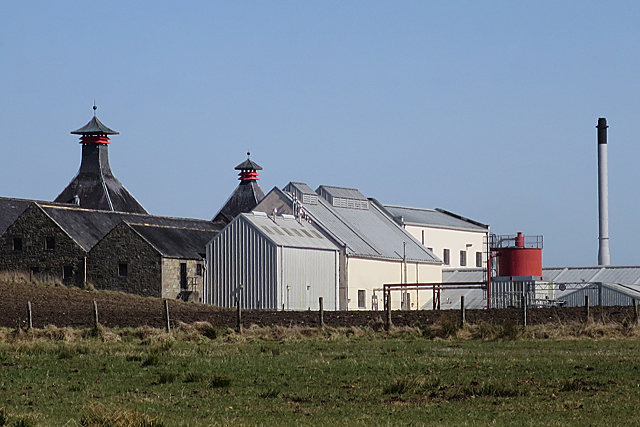
NJ1943 : Cardhu Distillery
taken 6 years ago, near to Cardow, Moray, Scotland
Also spelled Cardow, the distillery was founded in 1811 by Helen Cruickshank (1777-1874), whose husband John Cumming (1774-1846) was a notorious whisky smuggler. The story goes that when an exciseman was around, Helen warned her husband by displaying a red blanket at the window.
John made things legal when he licensed the distillery in 1824, just a year after a change in the law to allow licensing of distilleries.
Their son Lewis Cumming (1803-1872) succeeded his father, and after his death Lewis' wife Elizabeth Robertson (1827-1894) took over the business.
The original buildings were a short distance to the south-east of the present complex, which was built in 1884-1886 and then expanded in 1896-1897 after Elizabeth sold it to John Walker and Sons, now part of Diageo, in 1893.
Cardhu is an important component of the Johnnie Walker brand of blended whisky, but a range of single malts is also available, and are featured in Diageo's 'Classic Malts' selection.
Distillery tours are available.
See Link
 Map © Crown Copyright")
- Grid Square
- NJ1943, 27 images (more nearby 🔍)
- Photographer
- Anne Burgess (more nearby)
- Date Taken
- Thursday, 12 April, 2018 (more nearby)
- Submitted
- Friday, 13 April, 2018
- Subject Location
-
OSGB36:
 NJ 1914 4312 [10m precision]
WGS84: 57:28.2664N 3:20.9893W - Camera Location
-
OSGB36: NJ 1881 4309
- View Direction
- EAST (about 90 degrees)