2018
SO0602 : Ordnance Survey Rivet
taken 6 years ago, near to Troedyrhiw, Merthyr Tydfil/Merthyr Tudful, Wales
This is 1 of 2 images, with title Ordnance Survey Rivet in this square
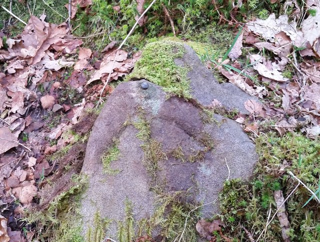
Ordnance Survey Rivet
This OS rivet can be found on a stone south of the track. It marks a point 207.828m above mean sea level.
 Map © Crown Copyright")
TIP: Click the map for more Large scale mapping
- Grid Square
- SO0602, 75 images (more nearby 🔍)
- Photographer
- Adrian Dust (more nearby)
- Date Taken
- Saturday, 14 April, 2018 (more nearby)
- Submitted
- Sunday, 15 April, 2018
- Subject Location
-
OSGB36:
 SO 0640 0200 [10m precision]
WGS84: 51:42.5340N 3:21.3628W - Camera Location
-
OSGB36: SO 0640 0200
- View Direction
- SOUTH (about 180 degrees)