2018
SC3474 : Richmond Hill Near the Incinerator
taken 6 years ago, near to Quine's Hill, Isle of Man
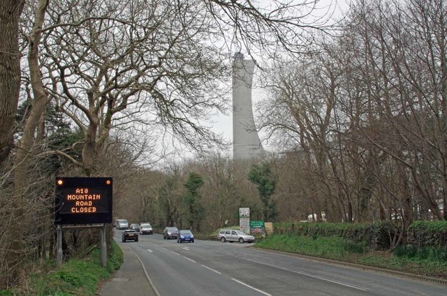
Richmond Hill Near the Incinerator
Bad luck for bikers wanting a blast over the top to Ramsey.. the road is closed.
 Map © Crown Copyright")
TIP: Click the map for more Large scale mapping
- Grid Square
- SC3474, 15 images (more nearby 🔍)
- Photographer
- Glyn Baker (more nearby)
- Date Taken
- Thursday, 12 April, 2018 (more nearby)
- Submitted
- Wednesday, 18 April, 2018
- Subject Location
-
OSGB36:
 SC 345 748 [100m precision]
WGS84: 54:8.5552N 4:32.0541W - Camera Location
-
OSGB36: SC 345 748
- View Direction
- East-northeast (about 67 degrees)