2018
ST4465 : Eastern end of the ramparts
taken 6 years ago, near to Yatton, North Somerset, England
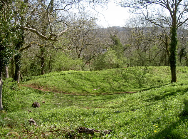
Eastern end of the ramparts
Cadbury Hill's east ramparts, part of the multiple sets here. Some believe the fort was smaller originally, and that these sets of earthworks were from a later period of expansion.
 Map © Crown Copyright")
TIP: Click the map for more Large scale mapping
- Grid Square
- ST4465, 50 images (more nearby 🔍)
- Photographer
- Neil Owen (more nearby)
- Date Taken
- Thursday, 19 April, 2018 (more nearby)
- Submitted
- Friday, 20 April, 2018
- Subject Location
-
OSGB36:
 ST 4434 6504 [10m precision]
WGS84: 51:22.9000N 2:48.0702W - Camera Location
-
OSGB36: ST 4429 6506
- View Direction
- East-southeast (about 112 degrees)