2018
TQ0584 : "District of Beaconsfield - Canal Way" sign at boundary
taken 6 years ago, near to Uxbridge, Hillingdon, England
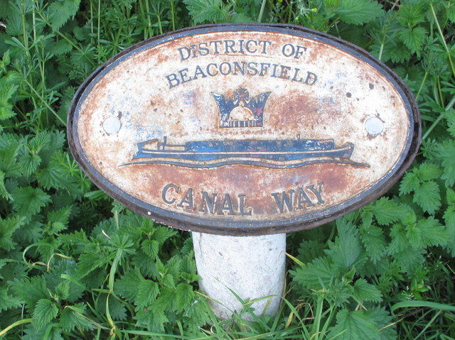
"District of Beaconsfield - Canal Way" sign at boundary
There is an adjacent sign for the canal way in the Borough of Hillingdon.
The District is now South Bucks. "The district was formed on 1 April 1974 by the Local Government Act 1972, by the amalgamation of the area of Beaconsfield Urban District with part of Eton Rural District. The district was originally named Beaconsfield: it was renamed to its present title on 1 April 1980, following the passing of a resolution by the district council. It is formally called 'South Bucks' rather than 'South Buckinghamshire'." - Wikipedia.
The District is now South Bucks. "The district was formed on 1 April 1974 by the Local Government Act 1972, by the amalgamation of the area of Beaconsfield Urban District with part of Eton Rural District. The district was originally named Beaconsfield: it was renamed to its present title on 1 April 1980, following the passing of a resolution by the district council. It is formally called 'South Bucks' rather than 'South Buckinghamshire'." - Wikipedia.
 Map © Crown Copyright")
TIP: Click the map for more Large scale mapping
- Grid Square
- TQ0584, 343 images (more nearby 🔍)
- Photographer
- David Hawgood (more nearby)
- Date Taken
- Thursday, 19 April, 2018 (more nearby)
- Submitted
- Friday, 27 April, 2018
- Subject Location
-
OSGB36:
 TQ 052 847 [100m precision]
WGS84: 51:33.0888N 0:29.0383W - Camera Location
-
OSGB36: TQ 052 847
- View Direction
- West-northwest (about 292 degrees)