2017
D3608 : A2 Coast Road approaching Ballygalley
taken 7 years ago, near to Carncastle, Co Antrim, Northern Ireland
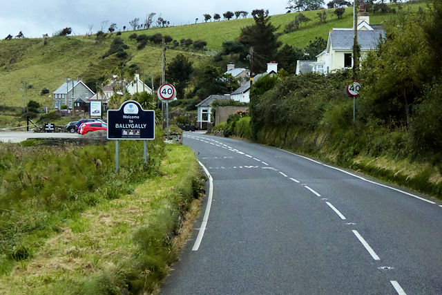
A2 Coast Road approaching Ballygalley
Ballygalley or Ballygally (from the Irish: Baile Geithligh, meaning "Geithleach's townland") is a small village and holiday resort which lies on the Antrim coast, approximately 3 miles north of Larne. It had a population of 714 in the 2001 Census (Wikipedia).
The A2 in Northern Ireland
The A2 in Northern Ireland is a major road which runs for 239 miles from the border crossing at Muff (where it becomes the Irish Regional Road R238) to Newry in County Down. A considerable length of the route is often referred to the Antrim Coast Road because much of it follows the scenic coastline of County Antrim; other parts of the road follow the coasts in Counties Down and Londonderry.
Loading map... (JavaScript required)
- Grid Square
- D3608, 12 images (more nearby 🔍)
- Photographer
- David Dixon (more nearby)
- Date Taken
- Thursday, 28 September, 2017 (more nearby)
- Submitted
- Sunday, 29 April, 2018
- Subject Location
-
Irish:
 D 361 086 [100m precision]
WGS84: 54:54.4379N 5:52.6808W - Camera Location
-
Irish: D 361 087
- View Direction
- South-southeast (about 157 degrees)