2018
NM8197 : Looking down to the Allt Coire an Fhir-eoin from an ascent of Coire Gorm
taken 6 years ago, near to Sgùrr Coire Nan Gobhar [hill or Mountain], Highland, Great Britain
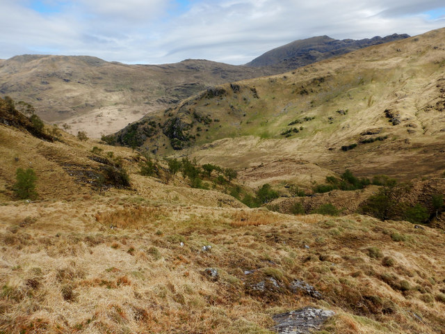
Looking down to the Allt Coire an Fhir-eoin from an ascent of Coire Gorm
Despite being a Corbett and not a Munro, Beinn Bhuidhe is a huge mountain and the full traverse from west to east (or vice versa) a very long walk. We had cut this down a little by a shorter ascent from Gleann Meadail, crossing the Allt Coire an Fhir-eoin and following the Allt a' Chomlaich until we could head up steep slopes into Coire Gorm. This unfrequented route is a little rough underfoot in places, though by no means the worst terrain we'd found in this long weekend trip, and got us onto the main ridge just half a kilometre west of the 855m summit.
 Map © Crown Copyright")
TIP: Click the map for more Large scale mapping
- Grid Square
- NM8197 (more nearby 🔍)
- Photographer
- Andy Waddington (more nearby)
- Date Taken
- Monday, 14 May, 2018 (more nearby)
- Submitted
- Thursday, 17 May, 2018
- Subject Location
-
OSGB36:
 NM 8179 9784 [10m precision]
WGS84: 57:1.1954N 5:35.7879W - Camera Location
-
OSGB36: NM 8174 9773
- View Direction
- North-northeast (about 22 degrees)