2018
NC3524 : Eastern rim of Creag Riabhach Loch nan Sgaraig
taken 6 years ago, near to Corrykinloch, Highland, Scotland
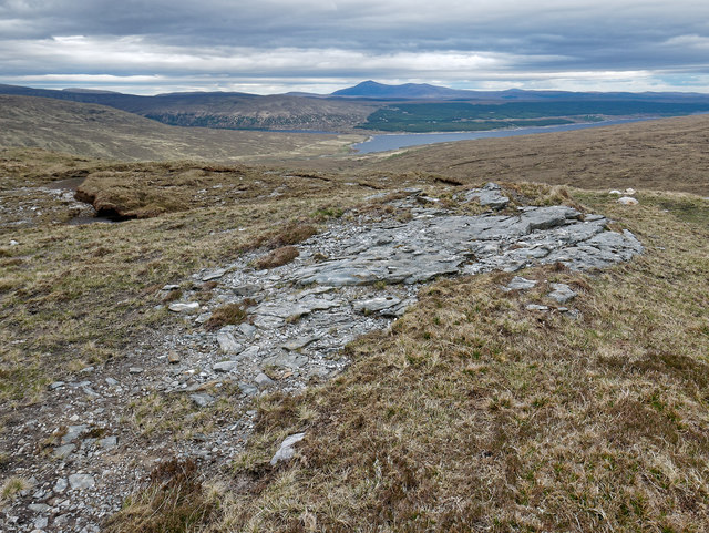
Eastern rim of Creag Riabhach Loch nan Sgaraig
Good walking on the hilltop and a view eastwards out to Loch Shin. Good to be on some rock after the deep peat of the lower moorland.
 Map © Crown Copyright")
TIP: Click the map for more Large scale mapping
- Grid Square
- NC3524, 2 images (more nearby 🔍)
- Photographer
- Julian Paren (more nearby)
- Date Taken
- Sunday, 20 May, 2018 (more nearby)
- Submitted
- Monday, 21 May, 2018
- Subject Location
-
OSGB36:
 NC 350 240 [100m precision]
WGS84: 58:10.4802N 4:48.3414W - Camera Location
-
OSGB36: NC 350 240
- View Direction
- EAST (about 90 degrees)