2016
SX8751 : The Lower Ferry in Dartmouth
taken 8 years ago, near to Dartmouth, Devon, England
This is 1 of 7 images, with title starting with The Lower Ferry in this square
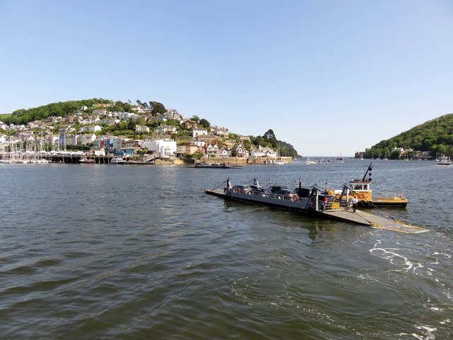
The Lower Ferry in Dartmouth
The ferry runs between Dartmouth and Kingswear.
 Map © Crown Copyright")
TIP: Click the map for more Large scale mapping
- Grid Square
- SX8751, 1040 images (more nearby 🔍)
- Photographer
- Steve Daniels (more nearby)
- Date Taken
- Tuesday, 24 May, 2016 (more nearby)
- Submitted
- Tuesday, 22 May, 2018
- Subject Location
-
OSGB36:
 SX 8791 5107 [10m precision]
WGS84: 50:20.9307N 3:34.6086W - Camera Location
-
OSGB36: SX 8788 5109
- View Direction
- Southeast (about 135 degrees)