2018
SZ0399 : Canford Magna: towards Canford School on the riverside path
taken 6 years ago, near to Canford Magna, Bournemouth, Christchurch & Poole, England
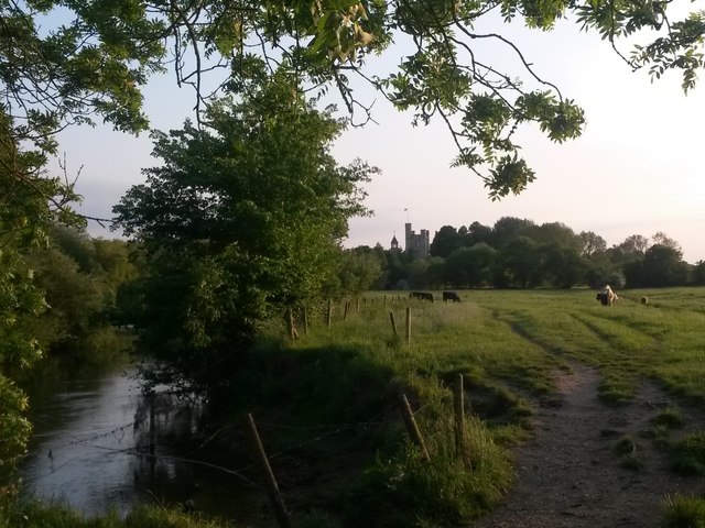
Canford Magna: towards Canford School on the riverside path
The path crosses what is slightly generously called a ford on larger scale maps, before diverging slightly from the riverbank on the approach to Canford School, whose tall tower we see in the background.
 Map © Crown Copyright")
TIP: Click the map for more Large scale mapping
- Grid Square
- SZ0399, 33 images (more nearby 🔍)
- Photographer
- Chris Downer (more nearby)
- Date Taken
- Tuesday, 22 May, 2018 (more nearby)
- Submitted
- Tuesday, 22 May, 2018
- Subject Location
-
OSGB36:
 SZ 0368 9916 [10m precision]
WGS84: 50:47.5198N 1:56.9494W - Camera Location
-
OSGB36: SZ 0369 9917
- View Direction
- Southwest (about 225 degrees)