2018
NN9071 : River Tilt upstream
taken 6 years ago, near to Balaneasie [other Features], Perth And Kinross, Great Britain
This is 1 of 4 images, with title starting with River Tilt in this square
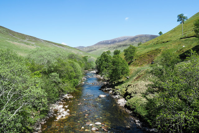
River Tilt upstream
The river as seen looking east from Gaw's Bridge with, in the distance, slopes descending from Bràigh Coire Cruinn-bhalgain.
 Map © Crown Copyright")
TIP: Click the map for more Large scale mapping
- Grid Square
- NN9071, 28 images (more nearby 🔍)
- Photographer
- Trevor Littlewood (more nearby)
- Date Taken
- Thursday, 24 May, 2018 (more nearby)
- Submitted
- Tuesday, 29 May, 2018
- Subject Location
-
OSGB36:
 NN 9020 7184 [10m precision]
WGS84: 56:49.5020N 3:48.0432W - Camera Location
-
OSGB36: NN 9012 7181
- View Direction
- East-northeast (about 67 degrees)