2018
SJ5608 : Wroxeter Roman City - May 2018 (1)
taken 6 years ago, near to Wroxeter, Shropshire, England
Wroxeter Roman City - May 2018 (1)
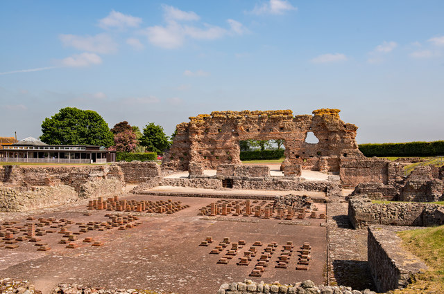
Wroxeter - or Viriconium Cornoviorum - was established circa 90AD, but abandoned in the 7th Century when the area was conquered by the Anglo-Saxon kingdom of Mercia. The area was eventually converted to farmland, with much of the Roman brick removed for building. Only a wall known as "The Old Work" remained until archaeological excavations began in 1859. Although much remains under the earth, the foundations of the bath house and the market place have been uncovered while a Roman villa have been constructed near the site of the forum.
This view shows "The Old Work" together with the foundations of the main bath house.
The site is in the care of English Heritage and additional information may be found: Link Any queries should be directed through this site.
This view shows "The Old Work" together with the foundations of the main bath house.
The site is in the care of English Heritage and additional information may be found: Link
 Map © Crown Copyright")
TIP: Click the map for more Large scale mapping
- Grid Square
- SJ5608, 224 images (more nearby 🔍)
- Photographer
- The Carlisle Kid (more nearby)
- Date Taken
- Wednesday, 23 May, 2018 (more nearby)
- Submitted
- Friday, 1 June, 2018
- Subject Location
-
OSGB36:
 SJ 565 086 [100m precision]
WGS84: 52:40.4444N 2:38.6331W - Camera Location
-
OSGB36: SJ 565 086
- View Direction
- NORTH (about 0 degrees)