2018
TQ9267 : The wharf, Job's Hole
taken 6 years ago, 3 km from Kemsley, Kent, England
The wharf, Job's Hole
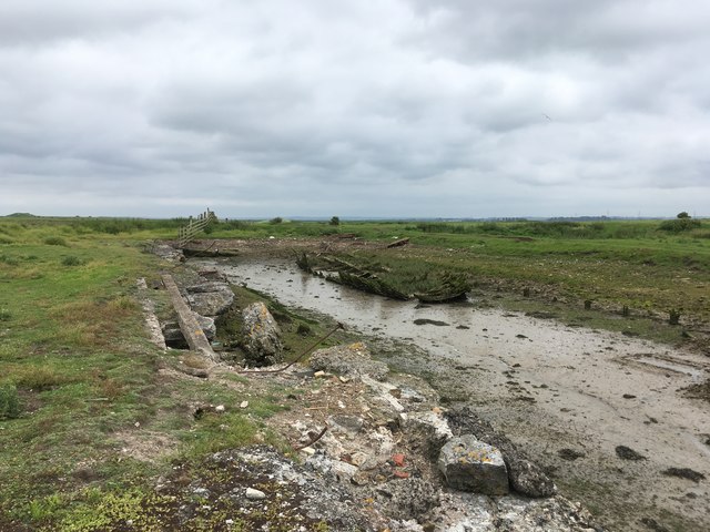
The wharf at Elmley cement works, which were closed early in the C20. The works were also known as Turkey cement works. Chalk was brought in by barge, as at that time, Elmley was an island, with no road connection to the Isle of Sheppey, let alone the mainland. In addition to the cement works, there were rows of workmen's cottages, and a pub (the Globe), but only rubble remains, almost all of it decaying concrete rather than brick. The track to Elmley Farm (now a footpath and bridleway) still passes the site of a church and schoolhouse which served this small industrial community and the farm holdings on the island. The 1908 OS County Series map gives this locality the name Job's Hole, but as the works had already closed by then, and the name does not appear on earlier or later maps, it may be unreliable.
 Map © Crown Copyright")
TIP: Click the map for more Large scale mapping
- Grid Square
- TQ9267, 56 images (more nearby 🔍)
- Photographer
- Hugh Craddock (more nearby)
- Date Taken
- Tuesday, 5 June, 2018 (more nearby)
- Submitted
- Friday, 8 June, 2018
- Subject Location
-
OSGB36:
 TQ 9264 6779 [10m precision]
WGS84: 51:22.5884N 0:45.9945E - Camera Location
-
OSGB36: TQ 9257 6781
- View Direction
- East-southeast (about 112 degrees)