2018
SR9694 : Lily - Bosherston Lily Ponds
taken 6 years ago, near to Bosherston, Pembrokeshire/Sir Benfro, Wales
This is 1 of 2 images, with title Lily - Bosherston Lily Ponds in this square
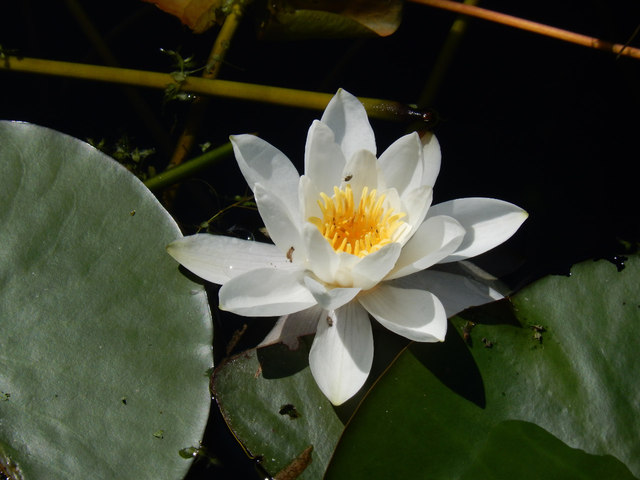
Lily - Bosherston Lily Ponds
Looking down at a near perfect lily in the western arm of the system.
Bosherston Lily Ponds :: SR9794
The Bosherston lily ponds are man-made, created by the Campbells of Cawdor, owners of the Stackpole Estate, between 1760 and 1840. Originally there was a series of wooded valleys containing spring-fed streams, fringed by swamp and wet woodland, that flowed into a tidal creek bordered by saltmarsh and dunes. This system was dammed primarily to form a landscape feature that has become known for its lily beds as well as a wide variety of wildlife. It is now part of the Stackpole National Nature Reserve and is managed by the National Trust.
 Map © Crown Copyright")
TIP: Click the map for more Large scale mapping
- Grid Square
- SR9694, 162 images (more nearby 🔍)
- Photographer
- Stephen McKay (more nearby)
- Date Taken
- Sunday, 3 June, 2018 (more nearby)
- Submitted
- Monday, 11 June, 2018
- Subject Location
-
OSGB36:
 SR 9685 9486 [10m precision]
WGS84: 51:36.9487N 4:56.1445W - Camera Location
-
OSGB36: SR 9685 9486
- View Direction
- SOUTH (about 180 degrees)