2018
SD9999 : Ruins of Peat Store for Surrender Lead Smelting Mill
taken 6 years ago, near to Kearton, North Yorkshire, England
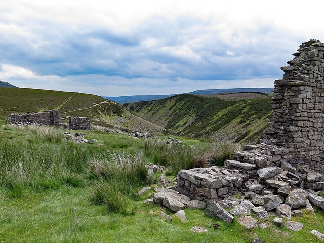
Ruins of Peat Store for Surrender Lead Smelting Mill
Peat store. Late C18 - early C19. Coursed rubble. 188 x 20 ft. Ruinous and surviving only partially at time of resurvey, with gable end walls and one pair of piers of bay divisions. A scheduled Ancient Monument (number 1228)
Grade II Listed Building (List Entry Number: 1295674): Link
Most of the length of the building is indicated by the remains of two rows of rubble pillars which supported the roof. The sides of the peat barn would have been open to allow the peat to dry.
Grade II Listed Building (List Entry Number: 1295674): Link
Most of the length of the building is indicated by the remains of two rows of rubble pillars which supported the roof. The sides of the peat barn would have been open to allow the peat to dry.
 Map © Crown Copyright")
TIP: Click the map for more Large scale mapping
- Grid Square
- SD9999, 51 images (more nearby 🔍)
- Photographer
- Andrew Curtis (more nearby)
- Date Taken
- Wednesday, 13 June, 2018 (more nearby)
- Submitted
- Wednesday, 20 June, 2018
- Subject Location
-
OSGB36:
 SD 9911 9994 [10m precision]
WGS84: 54:23.6961N 2:0.9128W - Camera Location
-
OSGB36: SD 99093 99949
- View Direction
- East-southeast (about 112 degrees)