2018
ST0689 : Ordnance Survey Cut Mark
taken 6 years ago, near to Pontypridd, Rhondda Cynon Taf, Wales
This is 1 of 5 images, with title Ordnance Survey Cut Mark in this square
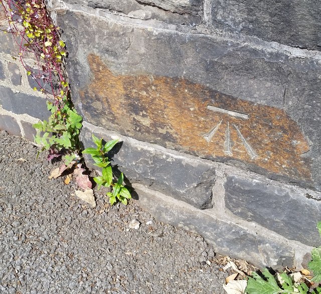
Ordnance Survey Cut Mark
This OS cut mark can be found on the NW parapet of the Railway Bridge on Albert Road. It marks a point 88.313m above mean sea level.
 Map © Crown Copyright")
TIP: Click the map for more Large scale mapping
- Grid Square
- ST0689, 101 images (more nearby 🔍)
- Photographer
- Adrian Dust (more nearby)
- Date Taken
- Saturday, 23 June, 2018 (more nearby)
- Submitted
- Sunday, 24 June, 2018
- Subject Location
-
OSGB36:
 ST 0695 8963 [10m precision]
WGS84: 51:35.8680N 3:20.6876W - Camera Location
-
OSGB36: ST 0695 8963
- View Direction
- Northwest (about 315 degrees)