2018
SS6949 : Lee Abbey
taken 6 years ago, near to Lynton, Devon, England
This is 1 of 39 images, with title Lee Abbey in this square
Lee Abbey
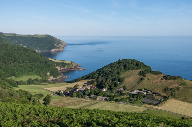
Looking down on Lee Abbey and its surrounding buildings from Southcliffe (or South Cleave), with Cuddycleave Wood above Duty Point above it and Lee Bay and Woody Bay, separated by Crock Point and leading round to Wringapeak, in the background.
Lee Abbey
Grade II listed house dating from the 1850s, extended in the 1920s and 1960s - see Link
.
Originally a private house, it was bought in 1924 with a view to converting it into a golfing hotel, resulting in the 1920s extension to the south of the original building. However the venture was not a success and bankruptcy followed. During the Second World War the building served as a school for evacuated boys. In 1945 it was purchased by a group of people who had run Christian house parties in school holidays during the war, and now serves as a Christian community and conference/retreat centre.
 Map © Crown Copyright")
TIP: Click the map for more Large scale mapping
- Grid Square
- SS6949, 246 images (more nearby 🔍)
- Photographer
- Ian Capper (more nearby)
- Date Taken
- Saturday, 23 June, 2018 (more nearby)
- Submitted
- Thursday, 28 June, 2018
- Subject Location
-
OSGB36:
 SS 698 493 [100m precision]
WGS84: 51:13.6926N 3:51.9330W - Camera Location
-
OSGB36: SS 703 491
- View Direction
- West-northwest (about 292 degrees)