SJ8198 : Salford Crescent
taken 6 years ago, 3 km from Rusholme, Manchester, England
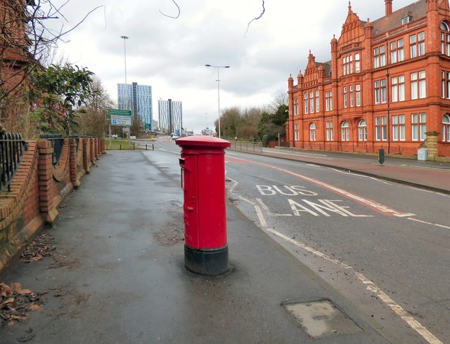
The A6 through Salford. In the foreground is an EIIR postbox (M5 91). On the left is Jubilee House SJ8198 : Working Class Movement Library, Salford. On the right is the Grade II listed Link
Designed by the architect Henry Lord and built in 1896, this was originally the Salford Royal Technical Institute which later became Royal Technical College, Salford (in 1921) and the Royal College of Advanced Technology (in 1956) which became the basis of the University of Salford which received its Royal Charter in 1967.
Along the way this building was renamed the Peel Building. Today it is home to the School of Environment & Life Sciences. It is a Grade II listed building (English Heritage ID:471601 LinkBritish Listed Buildings)
Link
The A6 is Britain's fourth longest road and one of the main historic north-south roads in England. It currently runs for 299 miles from Luton in Bedfordshire to Carlisle in Cumbria, although it formerly started at a junction with the A1 at Barnet.
Running north west from Luton, the road travels through Bedford, bypasses Rushden, Kettering and Market Harborough, continues through Leicester, Loughborough, Derby and Matlock before going through the Peak District to Bakewell, Buxton, Stockport, Manchester, Salford, Pendleton, Irlams o' th' Height, Pendlebury, Swinton, Walkden, Little Hulton, Bolton, Chorley, Preston, Lancaster, Kendal and Penrith before reaching Carlisle.
See Link
 Map © Crown Copyright")
- Grid Square
- SJ8198, 140 images (more nearby 🔍)
- Photographer
- Gerald England (more nearby)
- Date Taken
- Monday, 5 March, 2018 (more nearby)
- Submitted
- Tuesday, 10 July, 2018
- Subject Location
-
OSGB36:
 SJ 8194 9868 [10m precision]
WGS84: 53:29.0714N 2:16.4176W - Camera Location
-
OSGB36: SJ 8197 9865
- View Direction
- Northwest (about 315 degrees)