2018
SD3439 : Poulton Curve Halt (site), Lancashire
taken 6 years ago, near to Carleton, Lancashire, England
Poulton Curve Halt (site), Lancashire
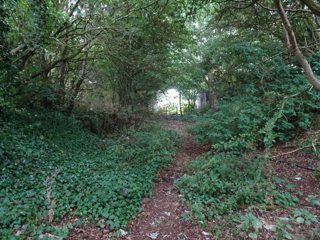
Opened in 1909 by the Preston & Wyre Joint Railway line from Blackpool to Fleetwood, this small station closed in 1952.
View south west towards Layton and Blackpool. Decayed remains of one of the wooden platforms can be made out to the left. The bridge carrying Tithebarn Street over the former railway can also be seen.
View south west towards Layton and Blackpool. Decayed remains of one of the wooden platforms can be made out to the left. The bridge carrying Tithebarn Street over the former railway can also be seen.
 Map © Crown Copyright")
TIP: Click the map for more Large scale mapping
- Grid Square
- SD3439, 171 images (more nearby 🔍)
- Photographer
- Nigel Thompson (more nearby)
- Date Taken
- Friday, 13 July, 2018 (more nearby)
- Submitted
- Sunday, 15 July, 2018
- Subject Location
-
OSGB36:
 SD 3448 3975 [10m precision]
WGS84: 53:50.9900N 2:59.8462W - Camera Location
-
OSGB36: SD 3449 3980
- View Direction
- South-southwest (about 202 degrees)