2018
SE4738 : Towton Dale
taken 6 years ago, near to Saxton, North Yorkshire, England
This is 1 of 2 images, with title Towton Dale in this square
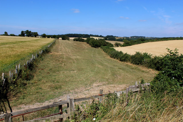
Towton Dale
Wars of the Roses - Battle of Towton, Palm Sunday, 29th March 1461.
Runs down to Bloody Meadow and Cock Beck
Bloody Meadow saw the final stages of the battle. The Yorkist army bolstered by fresh manpower under Norfolk, pursued the tired Lancastrians down the hollow into the shallow valley of Cock Beck. The watercourse was in violent spate, forcing the fleeing soldiers into entrapment. Many drowned trying to escape. The Yorkists, out for revenge for the killing of the Duke of York and the murder of his second son on Wakefield Bridge inflicted the worst butchery ever seen on a British battlefield.
At the battle end it is estimated that 28,000 lay dead (3% of the realm's population), the bloodiest conflict in British history.
This confirmed the Duke of York's eldest son as Edward IV, still only a teenager, who fought at the heart of the battle
Link
SE4738 : Bloody Meadow
SE4738 : Battlefield Trail
Battle of Towton
The Battle of Towton took place on the 29th March 1461 during the civil conflict known nowadays as the War of the Roses.
It has the grim distinction of being probably the largest and bloodiest battle ever fought on British soil.
It continued for 10 hours between an estimated 50,000 soldiers in a snowstorm on Palm Sunday.
3% to 4% of the English population perished in one day.
A decisive victory for the House of York confirmed Edward IV as King of England having recently replaced the hapless Lancastrian Henry VI
 Map © Crown Copyright")
TIP: Click the map for more Large scale mapping
- Grid Square
- SE4738, 50 images (more nearby 🔍)
- Photographer
- Chris Heaton (more nearby)
- Date Taken
- Wednesday, 11 July, 2018 (more nearby)
- Submitted
- Sunday, 15 July, 2018
- Subject Location
-
OSGB36:
 SE 4763 3826 [10m precision]
WGS84: 53:50.3049N 1:16.6604W - Camera Location
-
OSGB36: SE 4769 3823
- View Direction
- West-northwest (about 292 degrees)