2018
TR0027 : Footpath through a cornfield, July 2018
taken 6 years ago, near to Brenzett, Kent, England
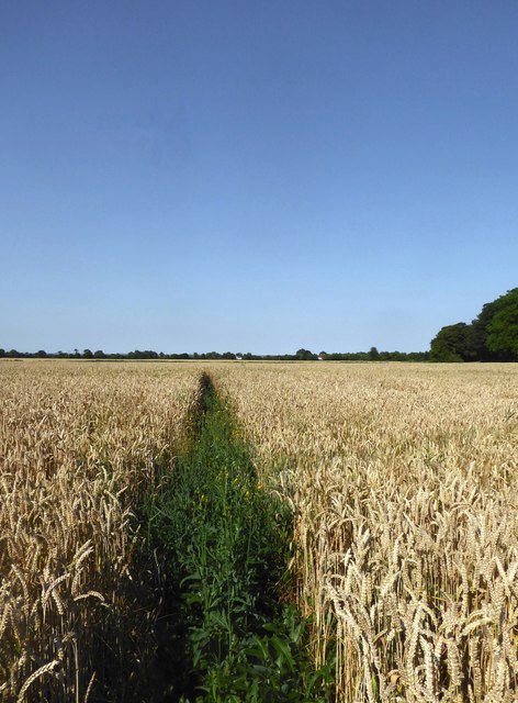
Footpath through a cornfield, July 2018
Without an OS map you would hardly guess that this path leads - within a few hundred yards - to Brenzett church, hidden among trees on the right.
In the July heatwave the wheat looks as good as ripe - though there were still signs of greenness nearer the church.
In the July heatwave the wheat looks as good as ripe - though there were still signs of greenness nearer the church.
 Map © Crown Copyright")
TIP: Click the map for more Large scale mapping
- Grid Square
- TR0027, 119 images (more nearby 🔍)
- Photographer
- Stefan Czapski (more nearby)
- Date Taken
- Sunday, 8 July, 2018 (more nearby)
- Submitted
- Monday, 16 July, 2018
- Subject Location
-
OSGB36:
 TR 0039 2770 [10m precision]
WGS84: 51:0.8255N 0:51.3256E - Camera Location
-
OSGB36: TR 0036 2768
- View Direction
- Northeast (about 45 degrees)