J1021 : The Newry Greenway viewed from the Fathom Road
taken 6 years ago, 3 km from Burren, Co Down, Northern Ireland
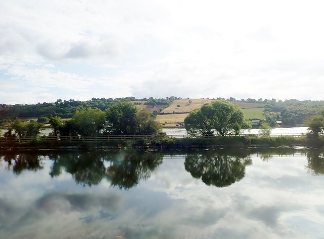
The embankment separating the Newry Ship Canal and the River Newry is known as the Middlebank. At present it is closed to the public for much its length. There are plans however to use the Middlebank as a link between the 20 mile Newry Canal Walk from Portadown to Newry and the Omeath - Carlingford Greenway. This would provide a motor vehicle free walking and cycling corridor from Portadown to Carlingford.
The embankment separating the Newry Ship Canal and the Newry River known as the Middlebank has been adapted to provide an extension link to the 30kms Newry Canal Trail from Portadown to Newry. It runs between Newry's Albert Basin and the Victoria Lock - a distance of 5.7 kms. Eventually, it will be extended across the Border to link with the existing Omeath - Carlingford Greenway thus providing a motor vehicle free walking and cycling corridor from Portadown to Carlingford.
- Grid Square
- J1021, 40 images (more nearby 🔍)
- Photographer
- Eric Jones (more nearby)
- Date Taken
- Tuesday, 17 July, 2018 (more nearby)
- Submitted
- Thursday, 26 July, 2018
- Subject Location
-
Irish:
 J 106 212 [100m precision]
WGS84: 54:7.7074N 6:18.5349W - Camera Location
-
Irish: J 105 212
- View Direction
- EAST (about 90 degrees)