2018
SX8754 : Maypool and the River Dart
taken 6 years ago, near to Dittisham, Devon, England
This is 1 of 6 images, with title starting with Maypool in this square
Maypool and the River Dart
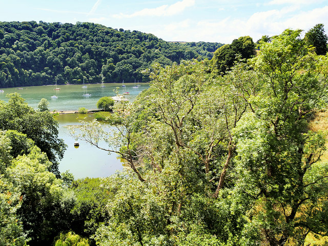
Travelling on the Dartmouth Steam Railway towards Kingswear, we get our first view of the River Dart as we pass over the Greenway Viaduct. The large patch of water on this side of the river is labelled "Fish Pond" on the six-inch Ordnance Survey map published in 1906.
 Map © Crown Copyright")
TIP: Click the map for more Large scale mapping
- Grid Square
- SX8754, 304 images (more nearby 🔍)
- Photographer
- David Dixon (more nearby)
- Date Taken
- Tuesday, 24 July, 2018 (more nearby)
- Submitted
- Monday, 30 July, 2018
- Subject Location
-
OSGB36:
 SX 877 543 [100m precision]
WGS84: 50:22.6978N 3:34.8190W - Camera Location
-
OSGB36: SX 879 544
- View Direction
- Southwest (about 225 degrees)