2018
TL4038 : Barley: The Town House
taken 6 years ago, near to Barley, Hertfordshire, England
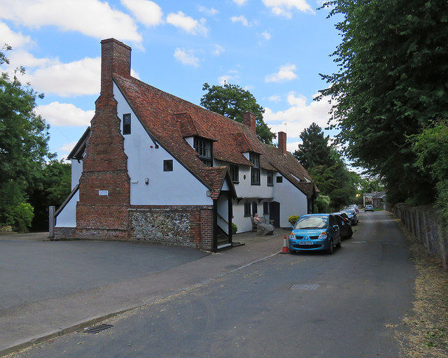
Barley: The Town House
Barley Village Hall is opposite the parish church. The Grade II* listing text begins "Formerly the Guildhall or Church House, used as a marriage feast room, free school, almshouses and for other public purposes; now a village hall. Early C16, altered c 1853 and c 1910. Built by the Guild of St Catherine. Timber frame on brick base".
 Map © Crown Copyright")
TIP: Click the map for more Large scale mapping
- Grid Square
- TL4038, 35 images (more nearby 🔍)
- Photographer
- John Sutton (more nearby)
- Date Taken
- Wednesday, 1 August, 2018 (more nearby)
- Submitted
- Wednesday, 1 August, 2018
- Subject Location
-
OSGB36:
 TL 4014 3843 [10m precision]
WGS84: 52:1.5952N 0:2.4718E - Camera Location
-
OSGB36: TL 4012 3841
- View Direction
- Northeast (about 45 degrees)