2018
TG2309 : 32 Colegate - parish boundary markers
taken 6 years ago, near to Norwich, Norfolk, England
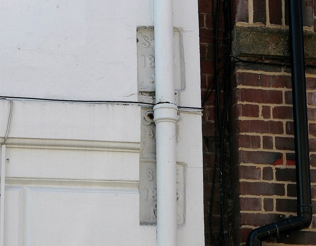
32 Colegate - parish boundary markers
Three parish boundary markers are hidden behind the drainpipe of The Merchants of Spice restaurant > Link which used to be known as the Black Boys Inn. The top and bottom markers both represent the parish of St Clement and date from 1809 and 1821. Part of Saint Clement's symbol, the anchor, can be discerned. The plate in-between the two marks the boundary of St George Colegate and dates from 1821.
See also my article: Link.
See also my article: Link.
 Map © Crown Copyright")
TIP: Click the map for more Large scale mapping
- Grid Square
- TG2309, 1928 images (more nearby 🔍)
- Photographer
- Evelyn Simak (more nearby)
- Date Taken
- Wednesday, 1 August, 2018 (more nearby)
- Submitted
- Thursday, 2 August, 2018
- Subject Location
-
OSGB36:
 TG 2305 0901 [10m precision]
WGS84: 52:37.9786N 1:17.6817E - Camera Location
-
OSGB36: TG 2304 0901
- View Direction
- South-southeast (about 157 degrees)