2018
SK3516 : Mill Lane Mews, Ashby-de-la-Zouch
taken 6 years ago, near to Ashby-de-la-Zouch, Leicestershire, England
This is 1 of 4 images, with title Mill Lane Mews, Ashby-de-la-Zouch in this square
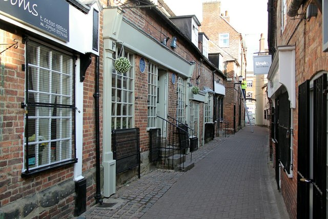
Mill Lane Mews, Ashby-de-la-Zouch
A narrow street with 18th century shops on the left hand side, being a development of the narrow burgage plots of the medieval period.
 Map © Crown Copyright")
TIP: Click the map for more Large scale mapping
- Grid Square
- SK3516, 430 images (more nearby 🔍)
- Photographer
- Alan Murray-Rust (more nearby)
- Date Taken
- Tuesday, 24 July, 2018 (more nearby)
- Submitted
- Friday, 3 August, 2018
- Subject Location
-
OSGB36:
 SK 3581 1679 [10m precision]
WGS84: 52:44.8530N 1:28.2566W - Camera Location
-
OSGB36: SK 3580 1682
- View Direction
- South-southeast (about 157 degrees)