2018
TG2208 : William Booth Street - parish boundary marker
taken 6 years ago, near to Norwich, Norfolk, England
This is 1 of 2 images, with title starting with William Booth in this square
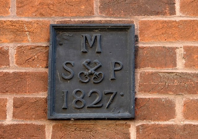
William Booth Street - parish boundary marker
 Map © Crown Copyright")
TIP: Click the map for more Large scale mapping
- Grid Square
- TG2208, 4039 images (more nearby 🔍)
- Photographer
- Evelyn Simak (more nearby)
- Date Taken
- Thursday, 2 August, 2018 (more nearby)
- Submitted
- Friday, 3 August, 2018
- Subject Location
-
OSGB36:
 TG 2293 0834 [10m precision]
WGS84: 52:37.6207N 1:17.5484E - Camera Location
-
OSGB36: TG 2292 0835
- View Direction
- East-southeast (about 112 degrees)