2018
SN9768 : Leominster and Abbey Cwmhir directions sign, East Street, Rhayader
taken 6 years ago, near to Rhayader/Rhaeadr Gwy, Powys, Wales
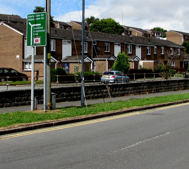
Leominster and Abbey Cwmhir directions sign, East Street, Rhayader
Alongside the A44 East Street. At the junction ahead, turn left for Abbey Cwmhir
or stay on the A44 for Leominster, roughly 55km or 35 miles away.
The sign shows that Leominster is Llanllieni in Welsh.
or stay on the A44 for Leominster, roughly 55km or 35 miles away.
The sign shows that Leominster is Llanllieni in Welsh.
 Map © Crown Copyright")
TIP: Click the map for more Large scale mapping
- Grid Square
- SN9768, 223 images (more nearby 🔍)
- Photographer
- Jaggery (more nearby)
- Date Taken
- Monday, 30 July, 2018 (more nearby)
- Submitted
- Monday, 6 August, 2018
- Subject Location
-
OSGB36:
 SN 9748 6826 [10m precision]
WGS84: 52:18.1715N 3:30.2969W - Camera Location
-
OSGB36: SN 9748 6824
- View Direction
- NORTH (about 0 degrees)