2018
TQ1973 : Path in Richmond Park
taken 6 years ago, near to Richmond, Richmond Upon Thames, England
This is 1 of 2 images, with title Path in Richmond Park in this square
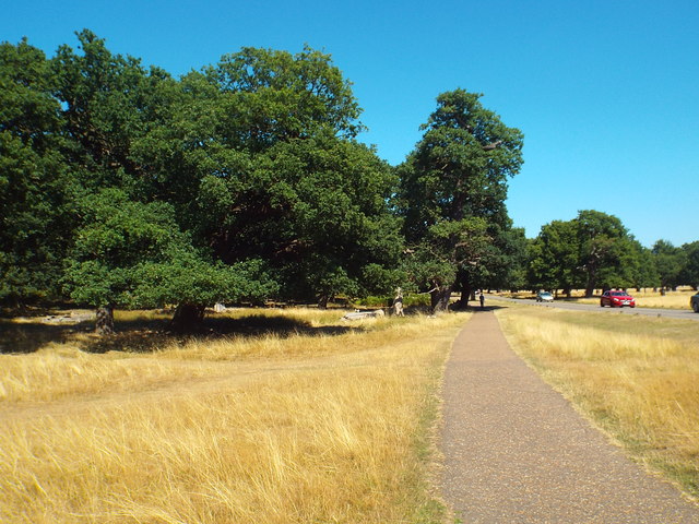
Path in Richmond Park
A path alongside a road in Richmond Park, in south west London.
This image was taken in August 2018 following a prolonged and almost unbroken spell of hot dry weather. The grass had turned yellow as a result of the heat and lack of rainfall.
This image was taken in August 2018 following a prolonged and almost unbroken spell of hot dry weather. The grass had turned yellow as a result of the heat and lack of rainfall.
Richmond Park :: TQ2073
Richmond Park is a 2,360 acre (3.69 sq mi) park within London. It is the largest of the Royal Parks in London and Britain's second largest urban walled park after Sutton Park, Birmingham. It is close to Richmond, Ham, Kingston upon Thames, Wimbledon, Roehampton and East Sheen. The park is famous for its red and fallow deer, which number over six hundred. The park is a National Nature Reserve. There is access to the park through several gates and many footpaths cross the park.
Website & map: Link
Wikipedia: Link
 Map © Crown Copyright")
TIP: Click the map for more Large scale mapping
- Grid Square
- TQ1973, 137 images (more nearby 🔍)
- Photographer
- Malc McDonald (more nearby)
- Date Taken
- Sunday, 5 August, 2018 (more nearby)
- Submitted
- Monday, 6 August, 2018
- Subject Location
-
OSGB36:
 TQ 1974 7382 [10m precision]
WGS84: 51:27.0428N 0:16.6919W - Camera Location
-
OSGB36: TQ 1971 7381
- View Direction
- East-northeast (about 67 degrees)