2018
TR1333 : Part of the Martello Lakes Housing Development
taken 6 years ago, near to West Hythe, Kent, England
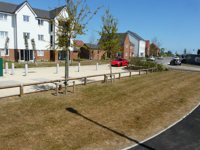
Part of the Martello Lakes Housing Development
Planning permission was approved, with conditions, by Folkestone and Hythe District Council under application number Y06/1079/SH for the outline application for mixed use development comprising residential development (1050 dwellings); employment development (use class B1, 15,000 sq.m); local centre (500 sq.m use classes A1/A2, 500 sq.m use classes A3/A4/A5); community centre /community facilities (1,000 sq.m use class D1); public open space (8.5 HA); structural open space (10.3 HA); retention and alteration of water bodies (retained area 15.5 HA); provision of two new access points to Dymchurch Road; and site restoration including raising of land levels. The location was given as Nickolls Quarry, Dymchurch Road, Hythe, Kent, CT21 4NE.
 Map © Crown Copyright")
TIP: Click the map for more Large scale mapping
- Grid Square
- TR1333, 118 images (more nearby 🔍)
- Photographer
- John Baker (more nearby)
- Date Taken
- Sunday, 8 July, 2018 (more nearby)
- Submitted
- Thursday, 9 August, 2018
- Subject Location
-
OSGB36:
 TR 1338 3320 [10m precision]
WGS84: 51:3.5086N 1:2.6149E - Camera Location
-
OSGB36: TR 1336 3322
- View Direction
- East-southeast (about 112 degrees)