2016
SJ3963 : Bench mark on Fir Tree Farm house - 12 Feb 2016
taken 8 years ago, near to Lache, Cheshire West And Chester, England
Bench mark on Fir Tree Farm house - 12 Feb 2016
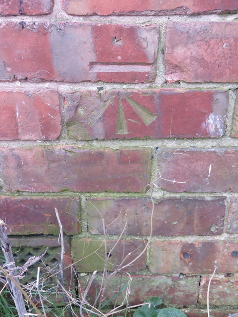
This Ordnance Survey bench mark was cut into the north east face of Fir Tree Farm house, next to the A483 Wrexham Road, outside Chester - SJ3963 : Fir Tree Farm house - 12 Feb 2016] The farm house had been abandoned for many years and was demolished sometime in 2018 - SJ3963 : Formerly Fir Tree Farm house
 Map © Crown Copyright")
TIP: Click the map for more Large scale mapping
- Grid Square
- SJ3963, 21 images (more nearby 🔍)
- Photographer
- John S Turner (more nearby)
- Date Taken
- Friday, 12 February, 2016 (more nearby)
- Submitted
- Thursday, 9 August, 2018
- Subject Location
-
OSGB36:
 SJ 3960 6350 [10m precision]
WGS84: 53:9.9106N 2:54.2941W - Camera Location
-
OSGB36: SJ 3961 6350
- View Direction
- Southwest (about 225 degrees)