2018
TR0041 : Housing development, Jemmett Road
taken 6 years ago, near to Ashford, Kent, England
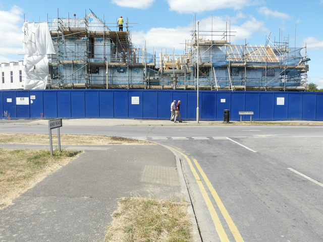
Housing development, Jemmett Road
Planning permission has been granted by Ashford Borough Council under application number 17/00354/AS for a reserved matters application for the development of 160 dwellings together with access roads, footpaths, drainage, associated car/bicycle parking provision, ground works, landscaping, open space and infrastructure (pursuant to outline approval 11/00405/AS - the demolition of existing buildings and construction of up to 241 dwellings and associated access and landscaping) .
This is how TR0041 : South Kent College, Jemmett Road looked before this building was erected on the development, which is to be known as Victoria Quarter. The TR0041 : Building site, Jemmett Road is part of the development.
This is how TR0041 : South Kent College, Jemmett Road looked before this building was erected on the development, which is to be known as Victoria Quarter. The TR0041 : Building site, Jemmett Road is part of the development.
 Map © Crown Copyright")
TIP: Click the map for more Large scale mapping
- Grid Square
- TR0041, 83 images (more nearby 🔍)
- Photographer
- John Baker (more nearby)
- Date Taken
- Tuesday, 10 July, 2018 (more nearby)
- Submitted
- Friday, 10 August, 2018
- Subject Location
-
OSGB36:
 TR 0027 4170 [10m precision]
WGS84: 51:8.3719N 0:51.6881E - Camera Location
-
OSGB36: TR 0032 4168
- View Direction
- West-northwest (about 292 degrees)