2018
NS0076 : Loch Riddon
taken 6 years ago, 3 km from Springfield, Argyll And Bute, Scotland
This is 1 of 3 images, with title Loch Riddon in this square
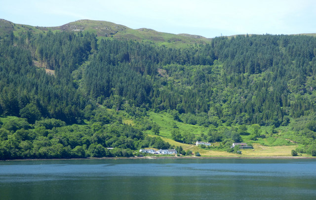
Loch Riddon
Also known as Loch Ruel. Glen Caladh Farm can be seen in this view from the B866 road.
The B866 Road between Colintraive and Springfield :: NS0275
Previously named the B8000 and later the A886, the single track road with passing places is now known as the B866. The present day A886 between Colintraive and Springfield follows a more direct inland and mountainous route than the old road.
If wishing to take in the scenery of the Kyles of Bute and Loch Riddon, then the B866 is a better choice than the A886, however it is more challenging to drive, due to being single track with many bends, dips and rises.
If travelling by bike, the B866 offers a much safer passage and better views of the Kyles of Bute and Loch Ridon/Loch Ruel.
 Map © Crown Copyright")
TIP: Click the map for more Large scale mapping
- Grid Square
- NS0076, 8 images (more nearby 🔍)
- Photographer
- Thomas Nugent (more nearby)
- Date Taken
- Monday, 2 July, 2018 (more nearby)
- Submitted
- Saturday, 11 August, 2018
- Subject Location
-
OSGB36:
 NS 0015 7667 [10m precision]
WGS84: 55:56.4841N 5:12.0984W - Camera Location
-
OSGB36: NS 0118 7667
- View Direction
- WEST (about 270 degrees)