2013
SP6180 : South Kilworth Road Bridge in Northamptonshire
taken 11 years ago, near to South Kilworth, Leicestershire, England
This is 1 of 2 images, with title South Kilworth Road Bridge in Northamptonshire in this square
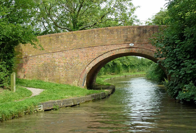
South Kilworth Road Bridge in Northamptonshire
South Kilworth Road Bridge is No 37 across the Leicester Section of the Grand Union Canal.
Grand Union Canal (Leicester Section)/Soar Navigation
The Leicester section branches off the main line at Braunston and it is 66 miles long with 59 locks (including two five chamber staircase locks at Foxton) and two tunnels. Near Leicester it continues into the River Soar, and briefly along the River Wreake. The navigation then proceeds along the river, with some canalised diversions, to Loughborough and the River Trent south of Long Eaton.
 Map © Crown Copyright")
TIP: Click the map for more Large scale mapping
- Grid Square
- SP6180, 59 images (more nearby 🔍)
- Photographer
- Roger D Kidd (more nearby)
- Date Taken
- Friday, 23 August, 2013 (more nearby)
- Submitted
- Thursday, 16 August, 2018
- Subject Location
-
OSGB36:
 SP 6175 8078 [10m precision]
WGS84: 52:25.2920N 1:5.6044W - Camera Location
-
OSGB36: SP 6173 8075
- View Direction
- North-northeast (about 22 degrees)