2018
SE3800 : #31 Hill Street
taken 6 years ago, near to Elsecar, Barnsley, England
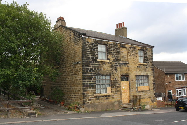
#31 Hill Street
Described by the Ordnance Survey as a public house, but probably only licensed for beer .. more than it does now! There is an OS benchmark SE3800 : Benchmark on #31 Hill Street on the near corner, left hand face, of the building, under the Parkins Yard name sign
 Map © Crown Copyright")
TIP: Click the map for more Large scale mapping
- Grid Square
- SE3800, 124 images (more nearby 🔍)
- Photographer
- Roger Templeman (more nearby)
- Date Taken
- Tuesday, 14 August, 2018 (more nearby)
- Submitted
- Thursday, 16 August, 2018
- Subject Location
-
OSGB36:
 SE 3819 0037 [10m precision]
WGS84: 53:29.9190N 1:25.5459W - Camera Location
-
OSGB36: SE 3817 0037
- View Direction
- EAST (about 90 degrees)