2018
ST1888 : Eastern boundary of Trethomas
taken 6 years ago, near to Trethomas, Caerphilly/Caerffili, Wales
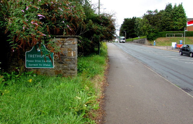
Eastern boundary of Trethomas
Alongside the A468 Newport Road from Machen. The Caerphilly County Borough Council website states that the village name is derived from tref, Welsh for town, and the name Thomas. The village developed after the opening of the Bedwas Navigation Colliery shortly before the First World War on the land of the local colliery owner, Sir William James Thomas (1867-1945), later Baron Ynyshir.
 Map © Crown Copyright")
TIP: Click the map for more Large scale mapping
- Grid Square
- ST1888, 174 images (more nearby 🔍)
- Photographer
- Jaggery (more nearby)
- Date Taken
- Friday, 10 August, 2018 (more nearby)
- Submitted
- Thursday, 16 August, 2018
- Subject Location
-
OSGB36:
 ST 1868 8869 [10m precision]
WGS84: 51:35.4701N 3:10.5160W - Camera Location
-
OSGB36: ST 1869 8869
- View Direction
- West-northwest (about 292 degrees)