2018
TG2308 : Parsonage Square
taken 6 years ago, near to Norwich, Norfolk, England
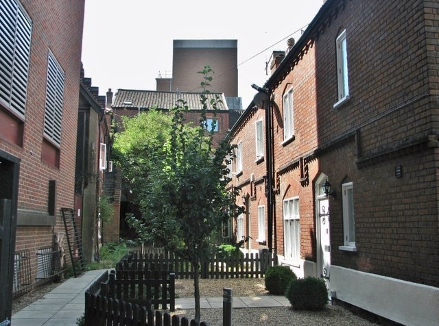
Parsonage Square
A short terrace at right facing the high brick wall of the adjacent Telephone Exchange building across a narrow yard. The 1884 Ordnance Survey map shows that this small yard was known as Parsonage Square, a name which it has since lost, perhaps because the adjacent St Andrews Parsonage no longer exists.
 Map © Crown Copyright")
TIP: Click the map for more Large scale mapping
- Grid Square
- TG2308, 6226 images (more nearby 🔍)
- Photographer
- Evelyn Simak (more nearby)
- Date Taken
- Friday, 17 August, 2018 (more nearby)
- Submitted
- Saturday, 18 August, 2018
- Subject Location
-
OSGB36:
 TG 2304 0867 [10m precision]
WGS84: 52:37.7957N 1:17.6591E - Camera Location
-
OSGB36: TG 2304 0868
- View Direction
- SOUTH (about 180 degrees)