SP6486 : Sheepwash Bridge north of Husbands Bosworth in Leicestershire
taken 11 years ago, near to Theddingworth, Leicestershire, England
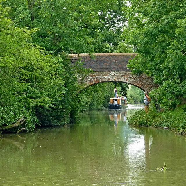
When the canals (or railways) were built in the 18th and 19th centuries, they were often routed in such a way that farmers and other landowners had their land bisected, so bridges had to be provided to allow access to fields on both sides of the canal. These bridges are frequently referred to as accommodation bridges, and however solid and well constructed, often don't lead anywhere except from one field to another.
The Leicester section branches off the main line at Braunston and it is 66 miles long with 59 locks (including two five chamber staircase locks at Foxton) and two tunnels. Near Leicester it continues into the River Soar, and briefly along the River Wreake. The navigation then proceeds along the river, with some canalised diversions, to Loughborough and the River Trent south of Long Eaton.
 Map © Crown Copyright")
- Grid Square
- SP6486, 53 images (more nearby 🔍)
- Photographer
- Roger D Kidd (more nearby)
- Date Taken
- Friday, 23 August, 2013 (more nearby)
- Submitted
- Sunday, 19 August, 2018
- Subject Location
-
OSGB36:
 SP 6496 8614 [10m precision]
WGS84: 52:28.1605N 1:2.7102W - Camera Location
-
OSGB36: SP 6499 8613
- View Direction
- West-northwest (about 292 degrees)