2018
SP8039 : Old Milestone by the former A5, Watling Street, Bradwell Abbey
taken 6 years ago, near to Wolverton, Milton Keynes, England
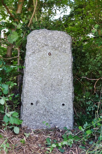
Old Milestone by the former A5, Watling Street, Bradwell Abbey
Stone post (plate lost) by the UC road (was A5), in parish of Bradwell Abbey (Milton Keynes District), Watling Street; Kiln Farm, 300m South East of Kiln Farm traffic island in vegetation by lamp post and pipeline sign, North-east side of road. Milton Keynes iron plate, erected by the Holyhead Road (Hockliffe Div) Turnpike Trust in the 19th century.
The last recorded inscription in 1958 read:-
(Stony Stratford 1)
(Fenny Stratford 5½)
Milestone Society National ID: BU_LH50.
The last recorded inscription in 1958 read:-
(Stony Stratford 1)
(Fenny Stratford 5½)
Milestone Society National ID: BU_LH50.
National Survey of Wayside Features by The Milestone Society
These images are from Link
 Map © Crown Copyright")
TIP: Click the map for more Large scale mapping
- Grid Square
- SP8039, 17 images (more nearby 🔍)
- Photographer
- Milestone Society (more nearby)
- Date Taken
- Friday, 22 June, 2018 (more nearby)
- Submitted
- Thursday, 23 August, 2018
- Subject Location
-
OSGB36:
 SP 8033 3917 [10m precision]
WGS84: 52:2.7069N 0:49.8072W - Camera Location
-
OSGB36: SP 8033 3917
- View Direction
- Northeast (about 45 degrees)